500 BLOCK - NORTH AND SOUTH SIDE EAST FOURTH STREET WALNUT STREET TO BROADWAY STREET
Front Page 1897 Snaborn Fire Insurance Map
Sanborn Fire Insurnace map 1897 showing north side of the street. College Street is on the right, Walnut Street is on the left.
Sanborn Fire Insurnace map 1897 showing south side of the street. College Street is on the right, Walnut Street is on the left.
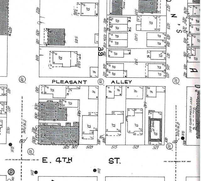
Sanborn Fire Insurnace map 1923 showing north side of the street. College Street is on the right, Walnut Street is on the left.
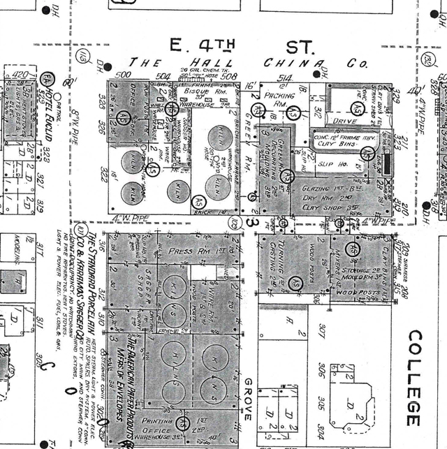
Sanborn Fire Insurnace map 1923 showing south side of the street. College Street is on the right, Walnut Street is on the left.
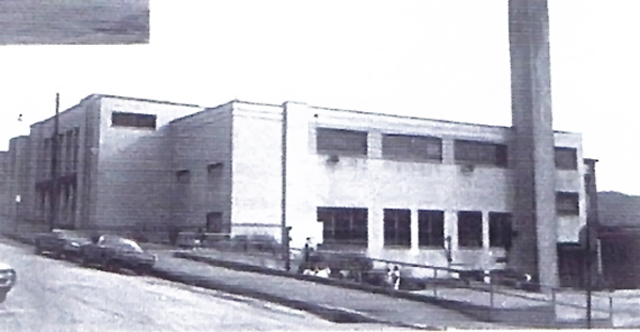
The Memorial Auditorium
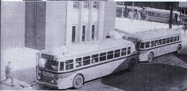
Before the Board Of Education bought school buses the citry bus company served that function
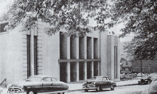
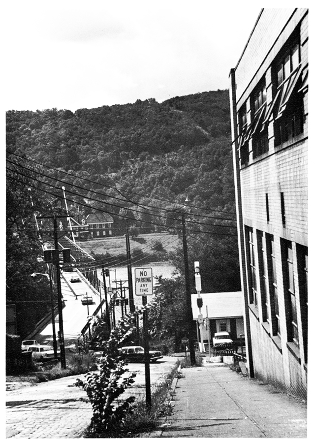
College Street looking down towards East 3rd Street and the Chester Bridge. The East side of the MA is the building on the right side of the picture.Sanborn Fire Insurnace map 1923 showing north side of the street. College Street is on the right, Walnut Street is on the left.
500 BLOCK - NORTH AND SOUTH SIDE EAST FOURTH STREET WALNUT STREET TO COLLEGE STREET- 2017
South East Corner of Walnut Street and East 4th Street. In the background is the Thompson House, the home of the East Liverpool Historical Society.
A 2017 look at where College Street drops down to Was was East 3rd Street and what had been the Chester Bridge.
600 BLOCK - NORTH AND SOUTH SIDE EAST FOURTH STREET COLLEGE STREET TO ELM STREET
Sanborn Fire Insurance Map, 1897. You can clearly see where college meets the Chester Bridge, locating East 4th (Robinson Street is buit harder to locate.
Sanborn Fire Insurance Map, 1897. You can clearly see where college meets the Chester Bridge, locating East 4th (Robinson Street is buit harder to locate.
Sanborn Fire Insurance Map, 1897. This map shows Elm Street between Pennsylvania Ave. and Robinson Street. Remember East 4th Steert was known as Robinson Street back then.
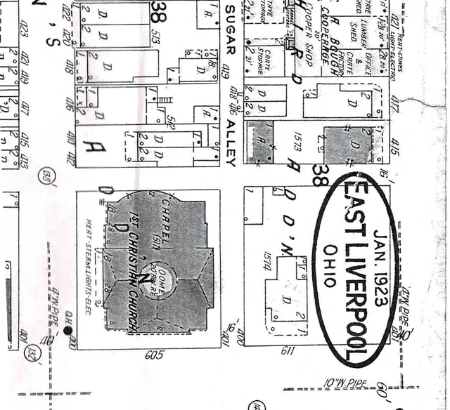
Sanborn Fire Insurance map 1923 showing North side of street College Street on the left Elm Street on the rignt.
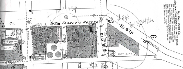
Sanborn Fire Insurance map 1923 showing South side of street College Street on the left Elm Street on the rignt.
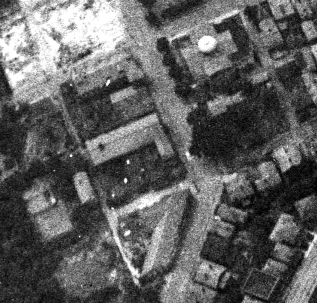
Aerial view of that same block probably late 1930s or early 1940's.
CONTINUE ON TO Fourth Street ELO Then and Now19
This site is the property of the East Liverpool Historical Society.
Regular linking, i.e. providing the URL of the East Liverpool Historical Society web site for viewers to click on and be taken to the East Liverpool Historical Society entry portal or to any specific article on the website is legally permitted.
Hyperlinking, or as it is also called framing, without permission is not permitted.
Legally speaking framing is still in a murky area of the law though there have been court cases in which framing has been seen as violation of copyright law. Many cases that were taken to court ended up settling out-of-court with the one doing the framing agreeing to cease framing and to just use a regular link to the other site.
The East Liverpool Historical Society pays fees to keep their site online. A person framing the Society site is effectively presenting the entire East Liverpool Historical Society web site as his own site and doing it at no cost to himself, i.e. stealing the site.
The East Liverpool Historical Society reserves the right to charge such an individual a fee for the use of the Society’s material.