|
|

|
|
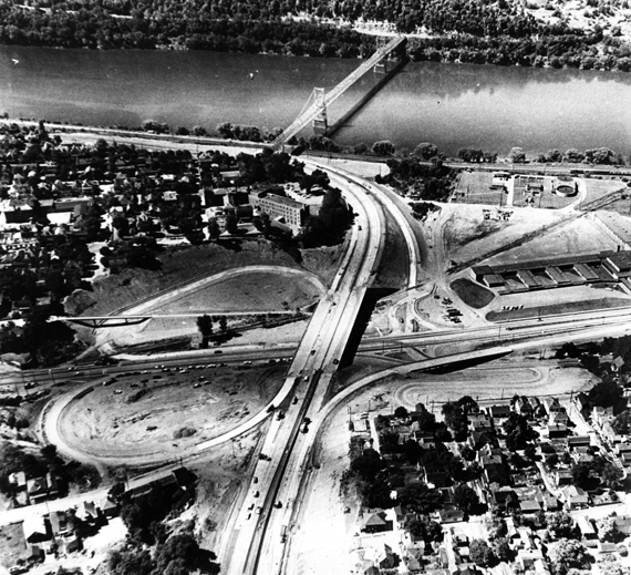
The work is reaching the finished stages in Phase 1 in the two pictures below.
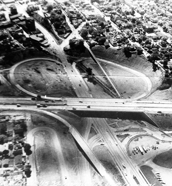
The Pictures above and below aren't the greatest quality but the original photos were striped like that.
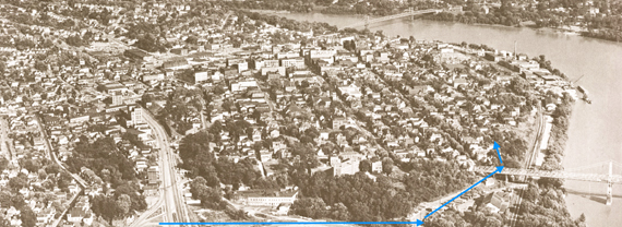
In the above picture you can see by the blue line the approximate route from the Cloverleaf area to the ending of the four lane highway in Phase 1.
Just as four lane passed under the Newell Bridge it quickly funneled down to a regular two lane residential street, Third Street to be exact.
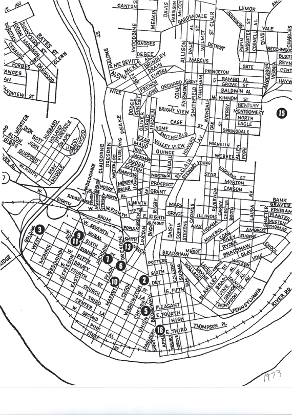
Basically the same except in map form showing the termination of the four lane highway that ended Phase 1.
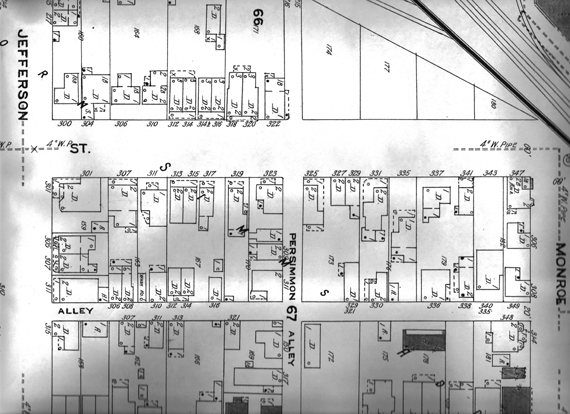
Three hundred block of West Third Street from a 1923 Sanborn Fire Insurance Map. The block looked the same in 1961-62 when Phase 1 was completed and Route 11 funneled onto W Third Street. When Phase 2 was completed some 25-30 years later this block no longer existed. However, slow "death" over that period of time of that block is evident in the next pictures
The "X" in this picture is placed at the intersection of West Third Street and Jefferson Street. There was a traffic light at that intersection after Phase 1 was completed. If you were standing at that intersection facing the Newell Bridge the following picture shows you what you would see:
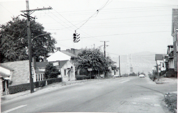
As you look back in the direction of the Newell Bridge you are seeing the 300 block of West 3rd Street. What you see above was the way things looked for close to the next 30 years. However, nothing remains exactly the same. The late 50s and early 60's found houses in this areas still inhabited. In 1961 the 300 block of West 3rd Street had 21 homes 18 were occupied, 3 were vacant. However, as time passed people moved out, owners no longer invested money in upkeep.
If you look at the "X" picture you will see a group of houses the along right side of the lower end of W. Third. In the picture directly above you can see those same houses from directly above.
The above Picture from Museum of Ceramics. Thanks to Sarah Vodrey for photographing the above photograph to be used in this project.
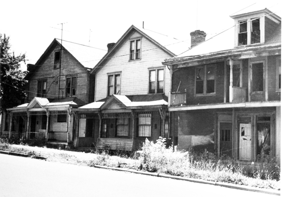
The exact date isn't known when the above picture was taken but based on other pictures of Third Street it appears to be the 1970's. Most if not all of the south side of Third Street took on that look as the years passed from the early 60's into the 80's and later. The entire area did begin to look like a war zone.
In 1970 the 300 block of West 3rd Street had 20 homes 5 of which were empty. In 1975 the 300 block of West 3rd Street had 18 homes 2 of which were empty. In 1980 the 300 block of West 3rd Street had 18 homes of which 11 were empty. In 1985 there were no homes left in the 300 block of west 3rd Street.
In Limbo: 200 Block, West Third St.
This site is the property of the East Liverpool Historical Society.
Regular linking, i.e. providing the URL of the East Liverpool Historical Society web site for viewers to click on and be taken to the East Liverpool Historical Society entry portal or to any specific article on the website is legally permitted.
Hyperlinking, or as it is also called framing, without permission is not permitted.
Legally speaking framing is still in a murky area of the law though there have been court cases in which framing has been seen as violation of copyright law. Many cases that were taken to court ended up settling out-of-court with the one doing the framing agreeing to cease framing and to just use a regular link to the other site.
The East Liverpool Historical Society pays fees to keep their site online. A person framing the Society site is effectively presenting the entire East Liverpool Historical Society web site as his own site and doing it at no cost to himself, i.e. stealing the site.
The East Liverpool Historical Society reserves the right to charge such an individual a fee for the use of the Society’s material.